


RIVERSIDE Voting District, Maricopa County, Arizona
About
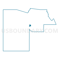
Outline

Summary
| Unique Area Identifier | 524016 |
| Name | RIVERSIDE Voting District |
| County | Maricopa County |
| State | Arizona |
| Area (square miles) | 11.33 |
| Land Area (square miles) | 11.31 |
| Water Area (square miles) | 0.02 |
| % of Land Area | 99.82 |
| % of Water Area | 0.18 |
| Latitude of the Internal Point | 33.42601580 |
| Longtitude of the Internal Point | -112.17156390 |
Maps


Graphs
Select a template below for downloading or customizing gragh for RIVERSIDE Voting District, Maricopa County, Arizona


Neighbors
Neighoring Voting District (by Name) Neighboring Voting District on the Map
- BETHUNE Voting District, Maricopa County, AZ
- BURGESS Voting District, Maricopa County, AZ
- CASH Voting District, Maricopa County, AZ
- CULVER Voting District, Maricopa County, AZ
- DOBBINS RANCH Voting District, Maricopa County, AZ
- HIDALGO Voting District, Maricopa County, AZ
- LATHAM Voting District, Maricopa County, AZ
- LAVEEN Voting District, Maricopa County, AZ
- MONTE VISTA Voting District, Maricopa County, AZ
- SENNIA VISTA Voting District, Maricopa County, AZ
- SHERIDAN Voting District, Maricopa County, AZ
- SULLIVAN Voting District, Maricopa County, AZ
- SUNRIDGE Voting District, Maricopa County, AZ
Top 10 Neighboring County Subdivision (by Population) Neighboring County Subdivision on the Map
Top 10 Neighboring Place (by Population) Neighboring Place on the Map
Top 10 Neighboring Elementary School District (by Population) Neighboring Elementary School District on the Map
- Cartwright Elementary District, AZ (112,047)
- Isaac Elementary District, AZ (43,107)
- Laveen Elementary District, AZ (40,902)
- Fowler Elementary District, AZ (29,756)
- Murphy Elementary District, AZ (17,265)
- Riverside Elementary District, AZ (6,752)
Top 10 Neighboring Secondary School District (by Population) Neighboring Secondary School District on the Map
Top 10 Neighboring State Legislative District Lower Chamber (by Population) Neighboring State Legislative District Lower Chamber on the Map
- State House District 16, AZ (247,146)
- State House District 13, AZ (207,107)
- State House District 14, AZ (158,881)
Top 10 Neighboring State Legislative District Upper Chamber (by Population) Neighboring State Legislative District Upper Chamber on the Map
- State Senate District 16, AZ (247,146)
- State Senate District 13, AZ (207,107)
- State Senate District 14, AZ (158,881)
Top 10 Neighboring 111th Congressional District (by Population) Neighboring 111th Congressional District on the Map
Top 10 Neighboring Census Tract (by Population) Neighboring Census Tract on the Map
- Census Tract 1125.05, Maricopa County, AZ (8,369)
- Census Tract 1125.13, Maricopa County, AZ (8,131)
- Census Tract 1147.03, Maricopa County, AZ (8,071)
- Census Tract 1126.02, Maricopa County, AZ (7,935)
- Census Tract 1125.11, Maricopa County, AZ (6,816)
- Census Tract 1125.02, Maricopa County, AZ (5,397)
- Census Tract 1123.01, Maricopa County, AZ (5,017)
- Census Tract 1124.02, Maricopa County, AZ (4,999)
- Census Tract 1125.10, Maricopa County, AZ (4,162)
- Census Tract 1125.14, Maricopa County, AZ (3,633)